
Building in a Flood Zone: Decisions to Make Before Design
Understand how official flood information, elevation, foundations, enclosures, utilities, drainage, and documentation shape a coastal home project.
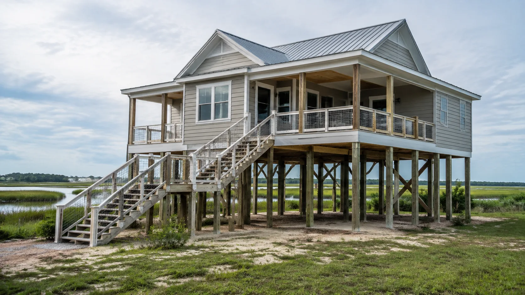
Do not start with the zone label alone
A flood-zone designation is an important screening input, but it is not the complete design brief. Confirm the exact parcel, effective official map information, flood elevation data, flood type, local freeboard or elevation requirements, and whether coastal wave action, erosion, drainage, or other overlays apply.
Use FEMA’s official mapping resources and the local floodplain administrator. A real-estate listing, third-party map, neighboring house elevation, or old survey is not a substitute for current parcel-specific verification.
Build a flood-design basis
Before schematic design, document:
- property and jurisdiction;
- effective map panel and revision date;
- mapped zone and applicable flood elevations;
- required design and finished-floor elevations;
- datum used for every elevation;
- expected water characteristics, including waves or velocity where applicable;
- erosion, scour, drainage, and soil information;
- required certificates, inspections, and closeout records;
- insurance or lender information the owner chooses to investigate.
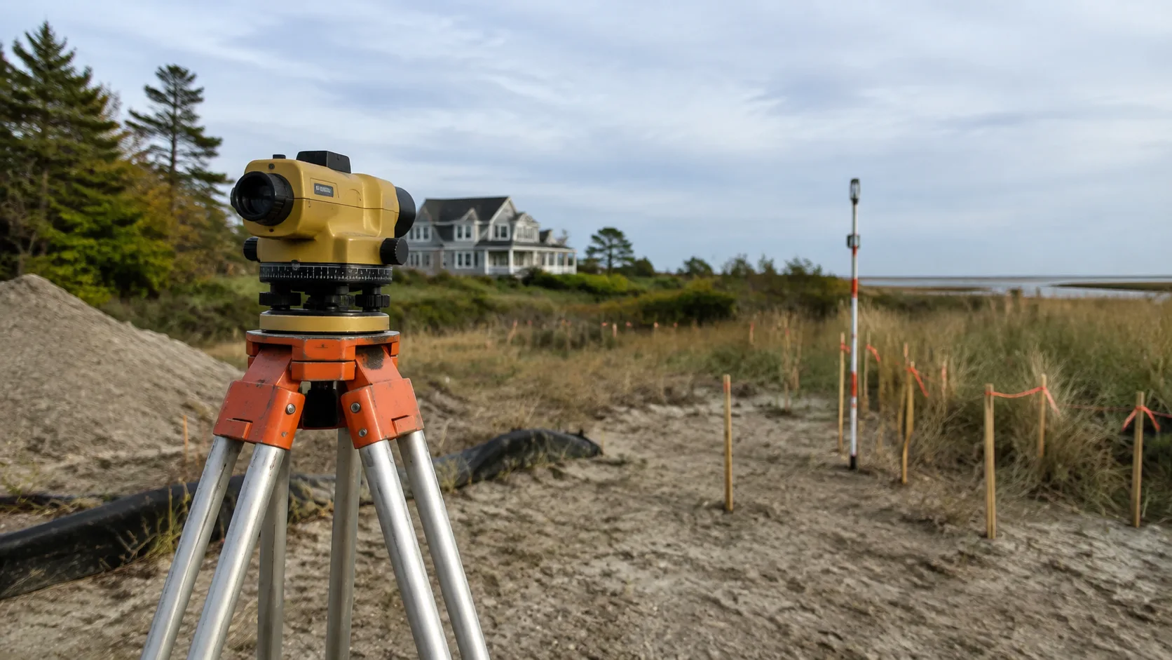
Elevation mistakes often come from mixing datums, benchmarks, or assumptions. Keep survey and design elevations in one coordinated record.
Coordinate foundation and site strategy
The foundation must suit structural loads, flood conditions, soil, erosion or scour potential, and local requirements. Possible approaches differ by flood condition and site; a foundation type that is common inland may be unsuitable in a coastal high-hazard area.
Site planning should preserve intended water paths. Fill, walls, landscaping, driveways, and enclosed areas can redirect water toward the building or adjacent property. Civil, geotechnical, structural, and survey input may all be needed.
Decide what happens below the elevated floor
Do not treat lower space as ordinary living or storage area without confirming what is allowed. Enclosures, breakaway construction, flood openings, materials, utilities, and use may be regulated. Owner expectations should be written early so the design does not quietly create noncompliant or high-loss space.
Questions to resolve include:
- Which uses are allowed below the required elevation?
- Must the space remain open or use a specific enclosure approach?
- Which materials and finishes can tolerate wetting and cleaning?
- Where can electrical, mechanical, plumbing, fuel, and communications components be located?
- How will stairs, ramps, parking, storage, and access work without blocking water movement?
Elevate and protect building services
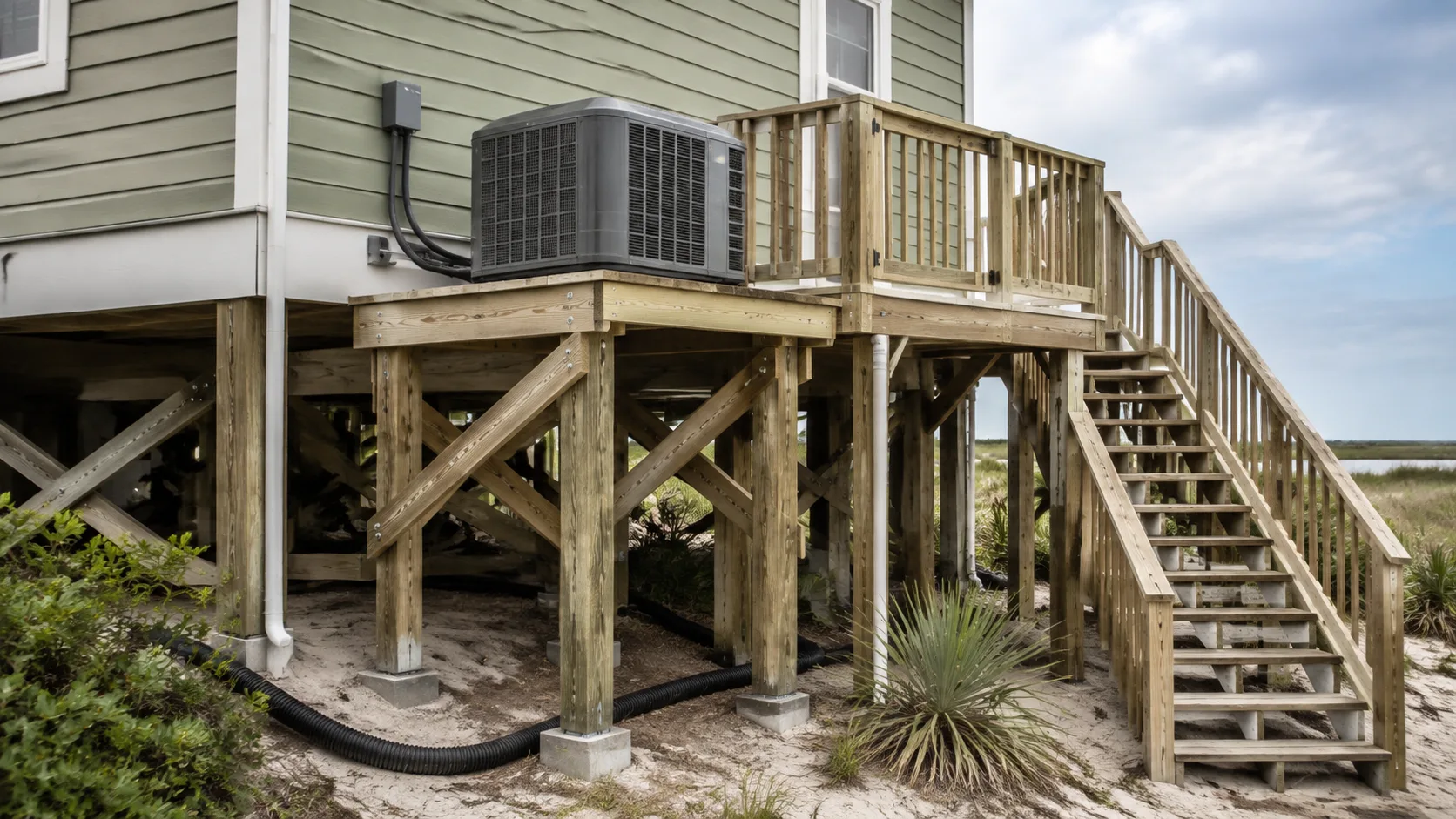
HVAC equipment, ducts, panels, receptacles, water heaters, controls, generators, tanks, and utility connections need coordinated locations and protection. Raising the occupied floor while leaving essential equipment vulnerable can produce a house that is technically elevated but unusable after flooding.
Penetrations and supports also affect the wind load path and enclosure. Coordinate this work with the hurricane-resistant construction guide and building-envelope guide.
Plan documentation throughout construction
Flood compliance may depend on records captured at specific stages. Ask the responsible authority which surveys, certificates, photographs, inspections, and as-built information are required and when.
A useful hold-point plan can include:
| Stage | Record to confirm |
|---|---|
| Before design | Official map research and existing survey |
| Foundation layout | Location and benchmark verification |
| Foundation progress | Required construction-stage elevation record |
| Floor framing | Lowest-floor or reference elevation verification |
| Rough-in | Utility and equipment elevations |
| Enclosures below | Openings, breakaway or material documentation |
| Final | Required elevation certificate and agency approvals |
The exact record names and stages vary by jurisdiction. Put them into the project schedule rather than discovering them at final inspection.
Consider access, use, and recovery
Elevation changes daily living. Review stairs, accessible routes, deliveries, parking, refuse, outdoor equipment, evacuation, and maintenance. Select lower-area materials and details for realistic exposure and cleanup. Create a post-flood plan for electrical safety, contamination, drying, and professional inspection.
Due-diligence checklist
- Confirm parcel and governing agencies.
- Retrieve current official flood information.
- Hire an appropriate surveyor and design team.
- Establish one elevation datum and benchmark.
- Resolve foundation, drainage, erosion, and scour questions.
- Place essential services above or protect them to governing requirements.
- Define allowable lower-space use and construction.
- Add certificates and inspections to the schedule.
- Coordinate flood, wind, moisture, and corrosion strategies.
- Retain final records with the property documents.
For Carolina-specific research starting points, use the Coastal Carolinas guide. For the full multi-hazard view, return to coastal building.
Make elevation information understandable to the whole team
Create one project sheet that names the survey datum, benchmark, relevant reference elevations, and the source of each value. Have the responsible surveyor and designers confirm how the values relate. Avoid translating between datums informally or using an unlabeled height from a neighboring property. Elevation decisions should remain traceable to authoritative information and project documents.
Ask where the required reference elevation is measured and which building element it concerns. A finished floor, structural member, equipment platform, and site grade are different physical locations. The governing requirements determine which matters for a particular purpose. Clear labels reduce misunderstandings between drawings, field layout, and construction-stage records.
Evaluate access as part of the elevated design
Raising occupied space affects stairs, landings, ramps where applicable, deliveries, parking, and maintenance routes. Discuss the household’s mobility and daily use during design. A technically feasible elevated floor can still create practical problems if the access arrangement is considered only after the building form is fixed.
Coordinate access structures with the foundation, flood behavior, and site circulation. Ask the responsible designers how attachments and supports are addressed. Plan the movement of large equipment and furnishings as well as people. These questions can reveal conflicts while the design can still be adjusted without dismantling completed work.
Clarify lower-space expectations with the owner
Write down what the owner intends to place below the occupied floor. Parking, storage, enclosure, equipment, and recreational use can involve different requirements and risks. Ask the floodplain administrator and design team to confirm what is allowed for the property rather than relying on the appearance of nearby houses.
The final drawings and owner instructions should agree. If an area has limits on use or enclosure, explain them clearly at handover. Later finishing or storage changes can undermine the original strategy. Keep the approved information with the property records so future work begins with an understanding of the design constraints.
Coordinate essential services as a package
Make a schedule of mechanical, electrical, plumbing, communications, and fuel-related components. Record proposed location, support, service access, and relevant protection requirements. Include controls and connections, not only large equipment. The design team should review the complete service route and identify vulnerable components that a high equipment platform alone would not address.
Use the custom home building guide to integrate those choices with the overall design. In an existing house, the remodeling guide helps frame investigation and access constraints before a retrofit is priced. A service improvement should be described as a complete scope with clear remaining limitations.
Review materials below vulnerable elevations carefully
Ask which materials and assemblies are permitted and appropriate for the anticipated conditions. The answer may depend on location, use, water exposure, and the governing rules. Record the specified products and installation conditions, including components concealed behind visible finishes.
The materials guide provides a comparison framework for compatibility and maintenance. Do not treat a washable face material as proof that the entire assembly can tolerate flooding. Adhesives, insulation, fasteners, cavities, and equipment may have different limitations. Have the project team explain cleaning, drying, and replacement assumptions for the complete assembly.
A hypothetical design review before purchasing a lot
Suppose an owner sees an elevated house nearby and assumes a similar design will work on a candidate property. Before relying on that comparison, obtain parcel-specific flood and survey information, determine the responsible jurisdiction, and discuss soil and access constraints with the relevant professionals.
The neighboring house may have different construction dates, approvals, elevations, or site conditions. Use it as inspiration rather than evidence of what is permitted. Create a list of unresolved facts that could change the building concept, then investigate them before committing to a price based on an assumed foundation or lower-level layout.
Ask about construction-stage records early
Determine which certificates, surveys, observations, and approvals are required at each stage. Name who orders them and who receives them. Include enough schedule allowance for the relevant work to be checked before proceeding. A missing document discovered at closeout can be difficult to reconstruct when the condition is concealed.
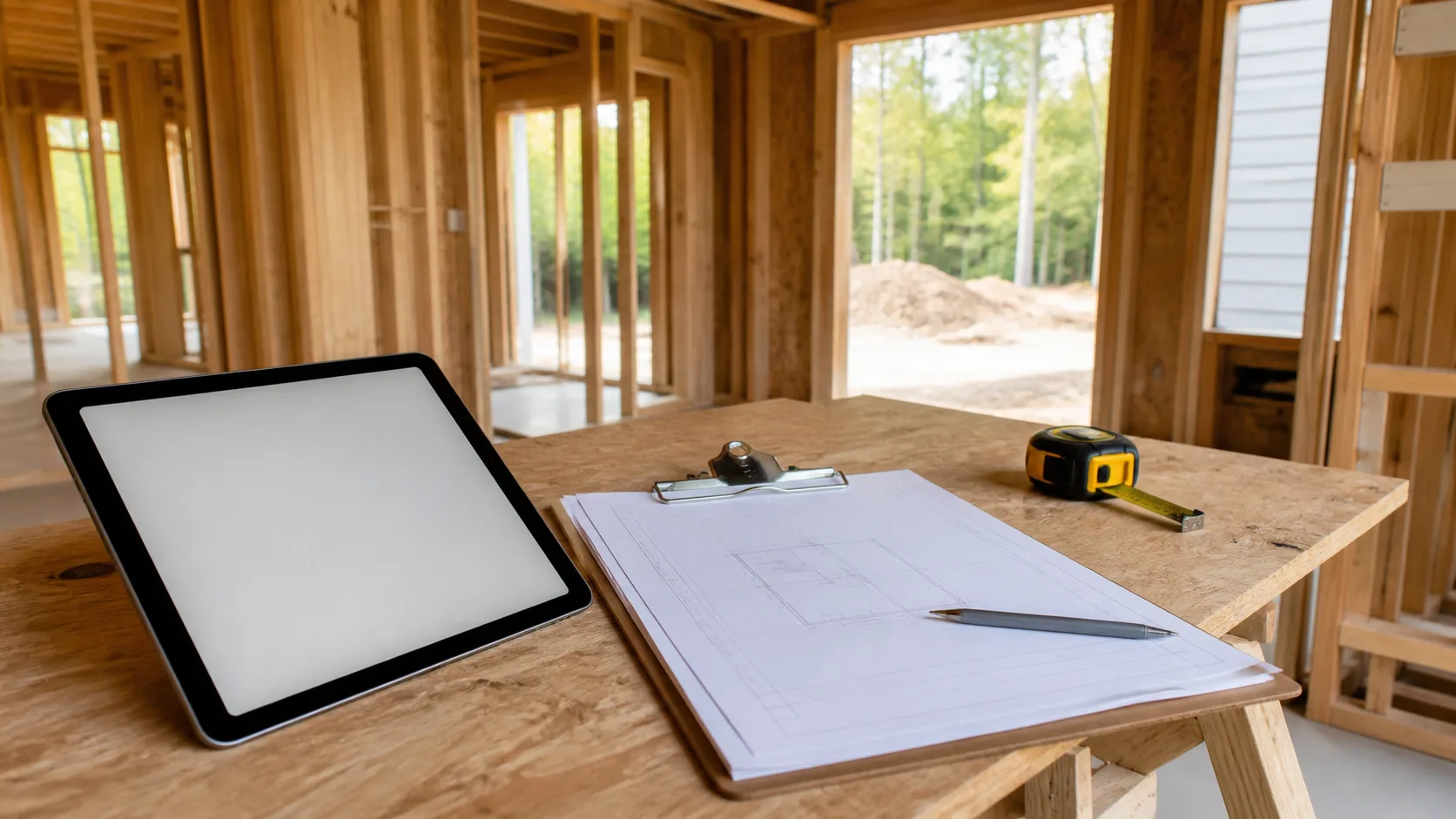
The construction planning guide shows how to maintain a hold-point and decision log. Keep approved changes connected to the records they affect. If an equipment location, floor reference, or enclosure detail changes during construction, confirm whether drawings or supporting documents also need revision.
Consider insurance and financing as separate due diligence
Ask the appropriate insurance and financing professionals what information they require and how proposed choices affect their evaluation. Do not assume code compliance guarantees a particular premium, coverage, or loan condition. Obtain current project-specific information and retain the assumptions behind any estimate.
Request project-specific insurance quotations and coverage explanations before design and procurement decisions become difficult to change. Coordinate the documents requested by those professionals with the survey and design record so everyone evaluates the same proposed property.
Plan for a change in conditions or project scope
Flood information and local requirements can change over time. Reconfirm the relevant information before submission and whenever the project materially changes. Distinguish effective information, preliminary information, and advisory material in the record. Ask the responsible authority how each should be used.
For renovations, determine whether the scope triggers additional review or documentation before expanding the work. Avoid assuming that an existing condition can be replicated without inquiry. The exact implications require local guidance, and the project team should document the answer rather than extending a prior approval by assumption.
Questions owners commonly ask
Does a mapped zone describe every possible flood problem? It is an important official input, but the team should also investigate parcel-specific drainage and other relevant site conditions. Ask what has and has not been evaluated.
Can equipment simply be moved upstairs? A different location also needs structural support, service routes, ventilation where applicable, drainage, noise review, and maintenance access. Coordinate the whole installation.
Where should I keep the final documents? Retain the approved design information, required certificates, inspections, and accepted changes with the property records. Make copies accessible to future qualified reviewers.
Which guide should come next? Review hurricane-resistant construction alongside flood planning, since elevation and structural choices can affect both hazards. Use the coastal building overview to keep the combined decisions organized.
For inland and coastal framing load paths, LVL header sizing, and bearing wall checks, see our Structural Framing & Foundations guide.
Primary Sources & Code References
- Coastal Construction Manual, Volume I FEMA · reviewed August 29, 2026
- FEMA Hazard Products Direct Download FEMA · reviewed August 29, 2026
- Residential Construction Brochure Horry County, South Carolina · reviewed August 29, 2026
Related Engineering Guides

Coastal Building Guide
A practical starting point for planning durable homes in hurricane, flood, salt-air, and hot-humid coastal conditions.
Read technical guide
Hurricane-Resistant Home Construction: A System-by-System Guide
Plan a hurricane-resistant home around site conditions, a continuous load path, protected openings, rain control, and verified installation.
Read technical guide
Coastal Carolinas Building Guides
A regional starting point for permit research, flood and wind questions, stormwater coordination, and coastal project due diligence in the Carolinas.
Read technical guide